Azie Azië Asia Noord en Zuid Korea South Korea North Korea Goryeo Korean Peninsula Democratic People’s Republic of Korea China
Sold
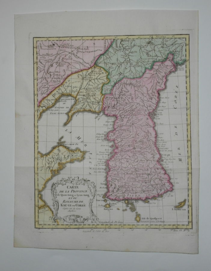
Carte de la Province de Quan-tong ouLyan-tong et du Royaume de Kau-Li ou Corée...
Without frame
21.5 x 27 cm
Original copper engraving manualy colored on paper
Zeer zeldzame kaart uit 1749, zeker handgekleurd, moeilijk te vinden! Cartograaf Jacques-Nicolas Bellin (1703-1772), toendertijd de Koninklijke Hydrograaf van Louis XV, beweerde dat de bronnen voor het maken van deze kaart door hem afgeleid waren van een Engelse kaart (zie vermelding in het Frans linksonder binnen het titelcartouche. Dit om een auteursrechtelijk geschil te voorkomen, terwijl hij in werkelijkheid het werk van zijn rivaal gebruikte monsieur Jean Baptiste Bourguignon d'Anville als zijn model. Die kaart was gebaseerd op het eerste systematische geografische onderzoek gedaan door een team van Franse jezuïeten (ca. 1700). / Very rae map, hard to find! Jacques-Nicolas Bellin (1703-1772), the Royal Hydrographer to Louis XV, claimed the present map to have derived his sources from "an English map" so as to avoid a copyright dispute, when in reality he used the work of his rival monsieur Jean Baptiste Bourguignon d'Anville's his model, that was based on the first systematic geographic survey by a team of French Jesuits (c. 1700).
Mooi stevig en gaaf papier, scherpe druk, prachtige inkleuring, en voldoende marge rondom.
Drawer: Jaques Nicolas Bellin ( 1703 - 1772 )
Engraver: Jacques van der Schley of Guillaume Dheulland?
Didot (à la Bible d' or, P' ris)
Composer of this collection: Monsieur Abbé Antoine François Prévost (1697-1763), e.a.
L' Histoire Generale des Voyages....(1746 - 1789)
Interesting links
Here are some interesting links for you! Enjoy your stay :)Categories
- No categories

 Karikaturale prent Grandville Spotprent Metamorphoses du Jour Spotprent
